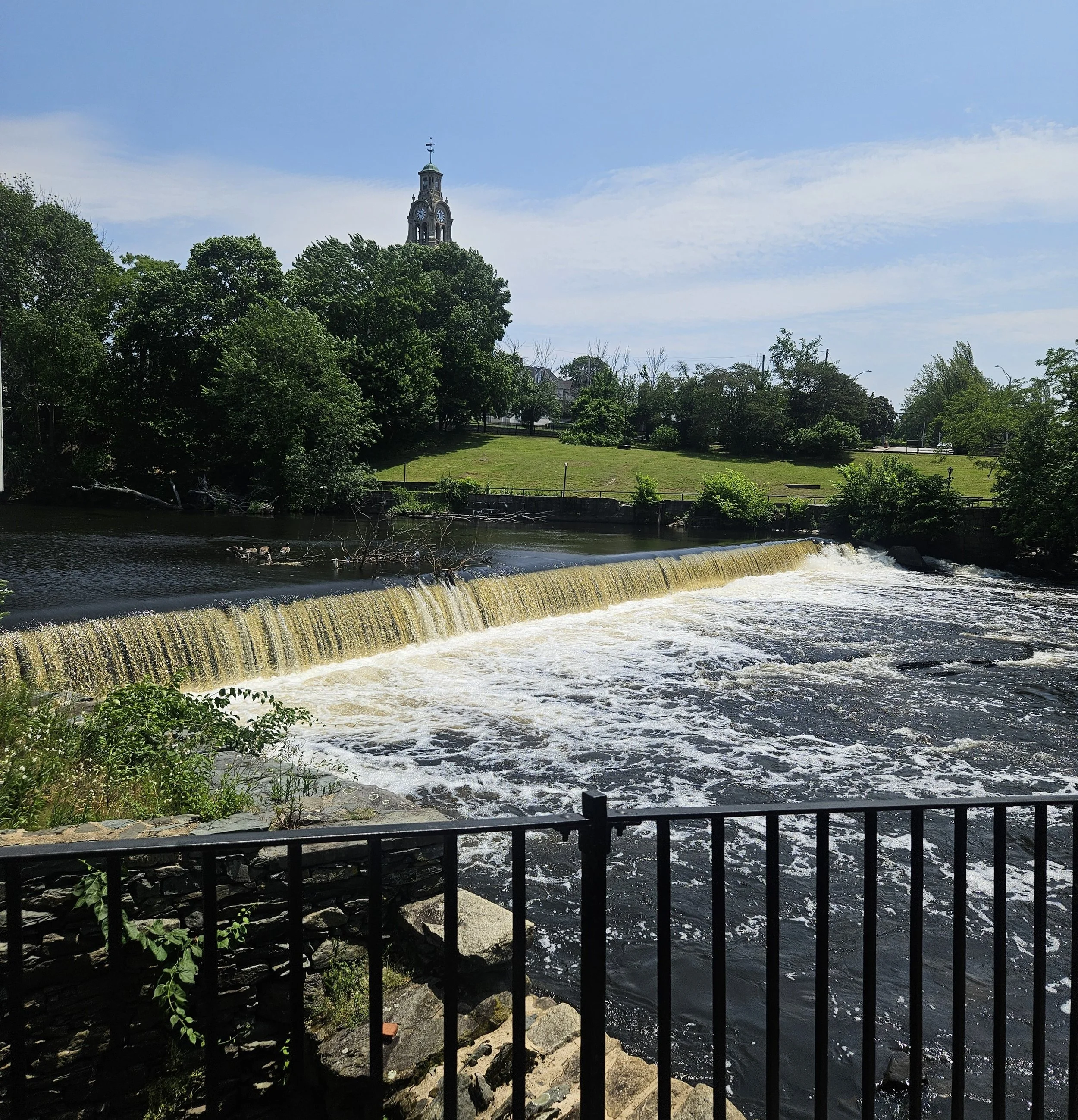
Aquatic Connectivity in the Narragansett Bay Region
Collaborative work between NBEP and partners to accelerate connectivity projects such as dam removal, fish passage, and culvert upgrades.
Collaborative work between NBEP and partners to accelerate connectivity projects such as dam removal, fish passage, and culvert upgrades. Visit the Aquatic Connectivity in the Narragansett Bay web page for more information.

Funding Opportunity: NBEP RFP for Capacity Building, Design, and Planning Activities to Improve Aquatic Habitat Connectivity in the Narragansett Bay Region
Proposals are due December 1st, 2025.
The Narragansett Bay Estuary Program (NBEP), through its host, Roger Williams University (RWU), seeks proposals for capacity building, design, and planning activities to improve aquatic habitat connectivity in the Narragansett Bay, Little Narragansett Bay, and Coastal Ponds watersheds in Rhode Island, Massachusetts, and Connecticut (Narragansett Bay Region). Federal funding is provided under the Infrastructure Investment and Jobs Act (IIJA) through EPA Cooperative Agreement #CE00A01336. Projects funded via this request will advance implementation of NBEP’s mission and Comprehensive Conservation and Management Plan (CCMP). The specific purpose of this opportunity is to fund 1. watershed-wide capacity building and planning activities that enable a clear future direction for aquatic barrier removal efforts that improve aquatic habitat connectivity and 2. site-specific design and planning activities that enable subsequent construction of projects that improve aquatic habitat connectivity.
$900,000 is available, with individual projects ranging from $75,000 to $250,000. Proposals are due December 1, 2025, and award notifications are expected by January 30, 2025.
View the full details of the RFP here.
Please see the RFP document for more information and email Jennifer Rogers (jrogers@nbep.org) with any questions.

Funding Opportunity: NBEP 2025 Outreach and Education RFP
Proposals are due April 11, 2025.

The Narragansett Bay Estuary Program (NBEP), through its host, Roger Williams University (RWU), seeks proposals for watershed outreach and education projects that help fulfill our vision of clean water and habitat to sustain all who live, work, and play in the Narragansett Bay Region. Visit our website for an interactive map of the Narragansett Bay Region to determine if your project location is eligible. Projects should seek to engage broad community participation in and ownership of solutions to pressing environmental problems facing Narragansett Bay, Little Narragansett Bay, the Rhode Island Coastal Ponds, and their watersheds.
$75,850 is available with a maximum of $15,000 for individual projects.
Proposals are due April 11th, 2025 at 5pm, and applicants will be notified of award status around May 16th, 2025.
Please see the RFP form for more information and email dmoore@nbep.org with any questions.

Funding Opportunity: NBEP RFP for Design and Planning Activities to Improve Aquatic Habitat Connectivity in the Narragansett Bay Region
The Narragansett Bay Estuary Program (NBEP), through its host, Roger Williams University (RWU), seeks proposals for design and planning activities to improve aquatic habitat connectivity in the Narragansett Bay, Little Narragansett Bay, and Coastal Ponds watersheds in Rhode Island, Massachusetts, and Connecticut (Narragansett Bay Region). Federal funding is provided under the Infrastructure Investment and Jobs Act (IIJA). Projects funded via this request will advance implementation of NBEP’s mission and Comprehensive Conservation and Management Plan (CCMP). The specific purpose of this opportunity is to fund site-specific design and planning activities that enable subsequent construction of projects that improve aquatic habitat connectivity and provide additional benefits for climate resilience. $390,000 is available with a proposal due date of January 24, 2025, and an expected award notification date of March 1, 2025.
Please see the RFP document for more information and email info@nbep.org with any questions.

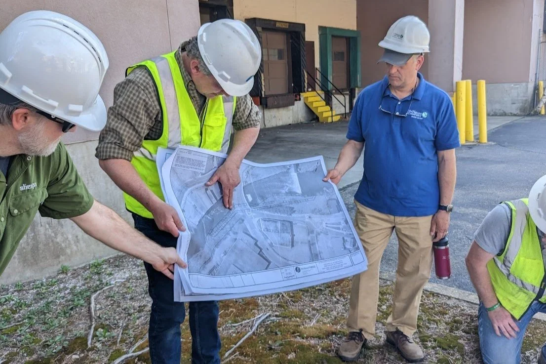

Lower Blackstone Fish Passage
Creating a path for achieving fish access above the first four dams on the Lower Blackstone River in Rhode Island. Visit the Lower Blackstone Fish Passage project page.

Blackstone Watershed Needs Assessment
NBEP convened partners across the Blackstone watershed to identify actionable needs and catalyze new projects to improve water quality, native habitat, and watershed resilience. Visit the Blackstone Watershed Needs Assessment project page.

Salt Ponds Coalition Story Map
In partnership with the Salt Ponds Coalition, we created a story map designed to communicate the Salt Ponds Coalition mission, volunteer efforts, and the history of the unique ponds.
Hundred Acre Cove Watershed GIS Tools
We created GIS tools to visualize stormwater infrastructure and septic system analyses. Our partner, Save the Bay, will use in these tools in their efforts to address nonpoint source pollution in Hundred Acre Cove in Barrington, RI.

Town of Warren - Flood and Hazard Planning
Technical support for the Town of Warren Flood Management & Hazard Mitigation Plan Steering Committee, including a parcel-level flood zone interactive map and critical assets and population vulnerability mapping.

General GIS Mapping - Technical Support
NBEP GIS staff can provide analysis and mapping services to fill in gaps for partners lacking GIS capacity, upon request. We draw from a wide array of data for the region, and produce new spatial datasets as needed.

Working Groups
Working groups at NBEP
We help to convene a variety of working groups that help us to focus on tackling specific questions in the Narragansett Bay region. For more information on working groups, click here.
Meetings and Events
At NBEP, we host a variety of meetings and events, including quarterly Steering Committee meetings and an Annual Science Event. Click here to see the upcoming meetings and events.